 An official website of the United States government.
 Official websites use.gov
A .gov website belongs to an official government organization in the United States.
Official websites use.gov
A .gov website belongs to an official government organization in the United States.
 Secure .gov websites use HTTPS
A lock or https:// means you’ve safely connected to the .gov website. Share sensitive information only on official, secure websites.
Secure .gov websites use HTTPS
A lock or https:// means you’ve safely connected to the .gov website. Share sensitive information only on official, secure websites.
Full Title: Expansion of www.mymobilebay.com [now known as ARCOS] for coastal Alabama resource management
This project improved and expanded an observing network and website that provides accurate real-time weather and water quality data to Alabama environmental managers and the public.
The Team: Brian Dzwonkowski (Lead Investigator, University of South Alabama, Dauphin Island Sea Lab) and Renee Collini (Mississippi State University)
Technical Monitor: Grace Gray (grace.gray@noaa.gov)
Federal Program Officer/Point of Contact: Frank Parker (frank.parker@noaa.gov)
This project began in June 2017 and ended in May 2021.
Award Amount: $720,000
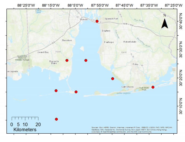
Why it matters: Effective management of coastal estuaries requires real-time and historical knowledge of water quality such as salinity, temperature, dissolved oxygen, and water clarity. Resource managers and stakeholders can use web-based tools that integrate this water quality data to inform decision-making in coastal waters such as when to close oyster harvesting areas due to poor water quality. Unfortunately, many Gulf of Mexico coastal regions lack web-based tools that effectively integrate available real-time and historical water quality data. However, decision-makers in Alabama have access to the Alabama Real-time Coastal Observing System (ARCOS) which provides high-quality, system wide, continuous real-time water and weather observations in a user-friendly web-based portal (https://arcos.disl.org/).
What the team did: The work conducted extended the spatial and temporal coverage for ARCOS and added more measures of water quality. This enhanced the usefulness of ARCOS for resource managers by providing them with additional information critical to making decisions about living coastal and marine resources in coastal Alabama. Specifically, the improvements to the ARCOS network included upgrading four older observing stations to enhance reliability and provide real-time water clarity data, and adding offshore real-time measurements of salinity, temperature, and dissolved oxygen by upgrading an existing data collection site.
Summary of Outcome: This project was focused on revitalizing the Alabama Real-time Coastal Observing System (ARCOS), a decision-support network, used by many regional stakeholders. To this effect the project modernized four of the seven inshore stations by upgrading the hydrographic sensor instrumentation, including expanding the networks monitoring capacity to include turbidity. These data were collected and delivered in real-time to the ARCOS website throughout the life of the project so that our wide range of stakeholders had immediate access to the information. In addition, the project expanded the spatial extent of ARCOS by bringing an existing offline research site (16 km offshore of Dauphin Island) into the network. The effort involved developing a mooring system that would collect surface and bottom water quality data and deliver it in near-real-time to the ARCOS website. The collection and delivery of bottom dissolved oxygen on the shelf of the Mississippi Bight was first of its kind in the region and a critical stream of new information for assessing the susceptibility of the Mississippi Bight to hypoxic, an open question in the northern Gulf of Mexico. As a part of this expansion, the website for ARCOS (formerly www.mymobilebay.com) was redesigned (https://arcos.disl.org/) to improve the user experience as well as improve the visibility of the network through the Dauphin Island Sea Lab webpage.
The historical nature of ARCOS allowed the project to begin with an established group of stakeholders in government agencies, academic institutions, commercial and industrial organizations, and a general recreational user community. However, growing stakeholder interest and potentially expanding the user community through the development of new applications was a natural way to promote the importance of this network as a tool for coastal decision-making. A particularly notable example of such new applications was developed from recognizing the importance of oceanic conditions in tropical storm forecasting. Data from the network was demonstrated to be useful in helping to identify conditions likely to support hurricane intensification prior to landfall. In short, the compounding impacts of a tropical storm (which mixes surface heat downward) followed by an atmospheric heatwave (which reheats the upper ocean) was critical to producing extreme ocean heat content, i.e., fuel for hurricanes. These findings were published in Nature Communications and were covered by local, national, and international media outlets. The paper received exceptional media coverage ranking top 5% of all research outputs scored by Altimetric including articles by the National Geographic, The New York Times, The Guardian, numerous other science focused websites as well as featured by a United Nations disaster risk reduction website. In addition, regional news outlets covered this research during the 2020 hurricane season (e.g., https://youtu.be/_g05O0CL1B4; https://youtu.be/rfVYt3w9WAo?t=724) demonstrating interest from the local weather forecasting community (i.e., local stakeholders). Importantly, due to the extremely active 2020 hurricane season, we reached out to the local, regional, and national weather service community to make them aware of these findings and how the ARCOS network could be used to improve hurricane intensity expectations prior to landfall in the Mississippi Bight region.
Finally, the expansion and revitalization of ARCOS that this project provided has positioned the network to continue collecting data so that the stakeholders will have this decision support tool available to them well beyond the life of this project.
From the seminar “Expanding Alabama’s Real-time Coastal Observing System for coastal management applications”
Presenter: Dr. Brian Dzwonkowski, University of South Alabama
Other Resources
Dauphin Island Sea Lab. 2018. Alabama Near Coastal Meteorological & Hydrographic Continuous Data Sampling from 2003 to present. NOAA National Centers for Environmental Information. Dataset.
Dzwonkowski, B., J. Coogan, G. Lockridge, C. Larence, and J. Wilson (2019). 2019 Summer Hypoxia Survey of Alabama Shelf CTD Data (2019-06-04 to 2019-08-02) (NCEI Accession 0206155). NOAA National Centers for Environmental Information. Dataset.
Dzwonkowski, B., and G. Lockridge. 2021. Fisheries Oceanography in Coastal Alabama (FOCAL) acoustic doppler wave and current profiler data from 2020-08-05 to 2021-06-03 (NCEI Accession 0241013). NOAA National Centers for Environmental Information. Dataset.
Dzwonkowski, B., and G. Lockridge. 2020. Fisheries Oceanography in Coastal Alabama (FOCAL) acoustic doppler wave and current profiler data 2018-06-21 to 2019-05-15 (NCEI Accession 0211052). NOAA National Centers for Environmental Information. Dataset.
Coogan, J., B. Dzwonkowski, K. Park, and G. Lockridge. 2019. West End CP Mooring thermistor, CTD, and ADCP Data near Mobile Bay, Alabama from 2004-10-20 to 2018-12-12 (NCEI Accession 0203749). NOAA National Centers for Environmental Information. Dataset.
Dzwonkowski, B., and G. Lockridge. 2019. CTD data collected from a Fisheries Oceanography in Coastal Alabama (FOCAL) transect on 2019-06-04 (NCEI Accession 0201339). NOAA National Centers for Environmental Information. Dataset.
Dzwonkowski, B., and G. Lockridge. 2021. Fisheries Oceanography in Coastal Alabama (FOCAL) hydrographic data from mooring from 2019-10-04 to 2020-02-28 (NCEI Accession 0243652). NOAA National Centers for Environmental Information. Dataset.
Dzwonkowski, B., and G. Lockridge. 2021. Fisheries Oceanography in Coastal Alabama (FOCAL) hydrographic data from mooring from 2020-09-30 to 2020-12-09 (NCEI Accession 0243653). NOAA National Centers for Environmental Information. Dataset.
Dzwonkowski, B., and G. Lockridge. 2021. Fisheries Oceanography in Coastal Alabama (FOCAL) hydrographic data from mooring from 2019-07-01 to 2019-08-16 (NCEI Accession 0243655). NOAA National Centers for Environmental Information. Dataset.
Dzwonkowski, B., and G. Lockridge. 2021. Fisheries Oceanography in Coastal Alabama (FOCAL) hydrographic data from mooring from 2020-02-28 to 2020-05-29 (NCEI Accession 0243657). NOAA National Centers for Environmental Information. Dataset.
Dzwonkowski, B., and G. Lockridge. 2021. Fisheries Oceanography in Coastal Alabama (FOCAL) hydrographic mooring data from 2020-07-17 to 2020-09-30 (NCEI Accession 0243684). NOAA National Centers for Environmental Information. Dataset.
Dzwonkowski, B., and G. Lockridge. 2021. Fisheries Oceanography in Coastal Alabama (FOCAL) wave energy converter platform (WECP) buoy hydrographic data from 2020-07-31 to 2020-09-02 (NCEI Accession 0243687). NOAA National Centers for Environmental Information. Dataset.
Dzwonkowski, B., and G. Lockridge. 2021. Fisheries Oceanography in Coastal Alabama (FOCAL) hydrographic data from mooring from 2019-08-16 to 2019-10-07 (NCEI Accession 0244000). NOAA National Centers for Environmental Information. Dataset.
Dzwonkowski, B., and G. Lockridge. 2021. Fisheries Oceanography in Coastal Alabama (FOCAL) hydrographic data from mooring from 2019-05-16 to 2019-07-01 (NCEI Accession 0244008). NOAA National Centers for Environmental Information. Dataset.
- Science Program Feature Story: What made Hurricanes Michael, Laura, and Sally so strong? Oct 15, 2020
- Hurricane Sally – Science and Summary from Chief Meteorologist Alan Sealls, NBC 15 WPMI, Sep. 25, 2020
- The secret behind Hurricane Sally’s pre-landfall intensification, NBC 15 WPMI, Sep. 25, 2020
- Science Program Feature Story: Expanded Observing System in Mobile Bay Reaches over 7000 Users, July 9, 2018