 An official website of the United States government.
 Official websites use.gov
A .gov website belongs to an official government organization in the United States.
Official websites use.gov
A .gov website belongs to an official government organization in the United States.
 Secure .gov websites use HTTPS
A lock or https:// means you’ve safely connected to the .gov website. Share sensitive information only on official, secure websites.
Secure .gov websites use HTTPS
A lock or https:// means you’ve safely connected to the .gov website. Share sensitive information only on official, secure websites.
By Hannah Brown
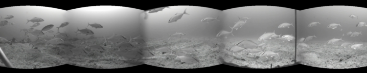
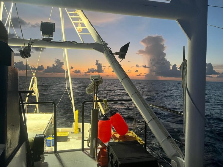
On the edge of an artificial reef, a spherical device drops down and slowly hits the sandy bottom. The device is composed of an array of six cameras, and it is recording the fish and their habitat in all directions. It records underwater for 30 minutes and then up it goes, pulled back onto the boat to collect the images for later analysis.
Throughout the summer this array is deployed at 2,000 different sites in the Gulf of Mexico to collect critical data on natural resources. The video surveys collected are part of the Gulf Fishery Independent Survey of Habitat and Ecosystem Resources (G-FISHER) project, a 10-year and $13.4 million research initiative funded by the National Oceanic and Atmospheric Administration (NOAA) RESTORE Science Program.
The program began in 2019 to create the Gulf’s most comprehensive database of reef fish and their habitats. This database will help inform stock assessments, ecosystem modeling, and other efforts. Additional funding for the project comes from the Department of the Interior through sportfish restoration grants, the state of Florida through saltwater license sales, and through the Southeastern Area Monitoring and Assessment Program (SEAMAP).
‘We’re Information Rich’
For more than 30 years, NOAA researchers have conducted video surveys of reef fish in the Gulf through SEAMAP’s Population and Ecosystem Monitoring Division.
“You can actually find video that started in 1992 with Hi8s [an early 8mm camcorder] and old camera tech that you wouldn’t believe what it looks like – these huge contraptions and stuff,” said Matt Campbell, chief for the Gulf and Caribbean Reef Fish Branch of NOAA’s Southeast Fisheries Science Center and partner on the G-FISHER project. “But it’s evolved, of course, since.”
One criticism of these early surveys was that they may not have provided the best indications of where fish stocks and their habitats were located.
“The reef fish surveys for years have been spatially limited, nothing really Gulf-wide,” said Ted Switzer, the project’s lead investigator and research scientist for the Florida Fish and Wildlife Conservation Commission’s Fish and Wildlife Research Institute (FWC FWRI).
To fill that gap, FWC began to survey inshore areas near the Florida panhandle and later expanded to the Florida Keys, the Panama City area, and the Alabama border. Historically, those surveys were conducted separately, but through the G-FISHER project these efforts have been united to create one comprehensive reef fish survey across the entire Gulf.
With the influx of increased data from the survey, the team has become what Campbell calls “information rich,” which has instigated the development of new technologies. When the data collection was smaller, the videos for the survey were manually coded by a person staring at footage for hours. As the research progressed to include more data collection points, G-FISHER has integrated technology that processes the videos, which helps make the survey analysis more efficient.
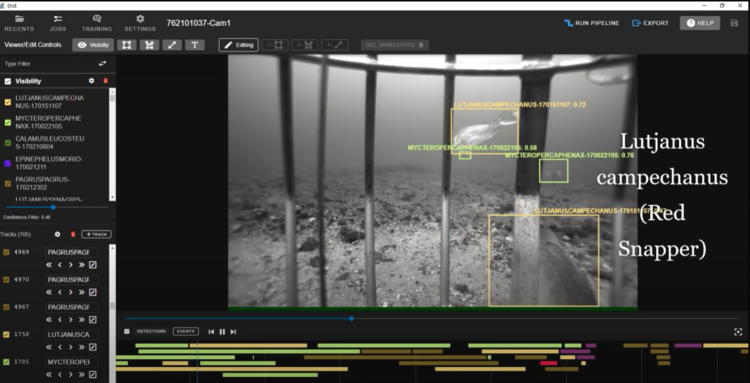
The project team uses an artificial intelligence software called VIAME, which stands for Video and Image Analytics for Marine Environments. The program was trained to identify common reef fish as one staff member manually drew a box around the bodies of fish after fish and labeled them until the program had enough occurrences of fish in different orientations, phases, conditions, and lighting to be able recognize them on its own. Now it has hundreds of thousands of images of 140 species to reference.
By using frames from the multiple cameras included in a single unit, the program is also able to track the pathways of individual fish, following their behavior as they move from one frame to the next. Through this capability, the program can keep track of how many distinct individuals are present at a single site, which improves the precision of abundance estimates. While the technology is progressing and showing promise for expediting survey analysis, it has a way to go before it can be fully incorporated into the process of analyzing video surveys.
“What’s cool with this particular program is now it’s gone from where we had to have a guy sit there and draw all those boxes and make those labels, the artificial intelligence is smart enough now where we can run it through new video, correct all the classifications, and then retrain the next library,” Campbell said. “So it iteratively gets significantly better because we’re feeding it so much more information.”
Mapping the Gulf’s Habitats
To make sure the cameras are deployed in the right areas to observe reef fish, the project relies on databases of Gulf habitats, which presents another challenge.
“Unfortunately, in the Gulf of Mexico, we don’t have great habitat mapping data,” Switzer said. “We have had very little information on the habitat from the outset, and we knew that we were never going to have enough money to map the Gulf of Mexico – that would be a $300-400 million project to do that right. So, what we have done is we have implemented randomized mapping.”
Site selection involves randomly picking a point and then conducting a mapping survey around that point to better understand the habitats there. From that information, the team identifies a reef and adds it to their series of sites for video surveys. By using a randomized approach, the researchers are also able to generalize those findings to unmapped areas.
Sean Keenan, an assistant research scientist at FWC FWRI, has witnessed this process unfold from beginning to end – seeing habitats mapped for the first time and then, eventually, observing the grouper, sponges, and other organisms that rely on those habitats through video surveys.
“It’s pretty amazing to see the connection between the whole project,” Keenan said.

While the project prioritizes going to new areas to identify new habitats, they also revisit areas that were mapped in the past to see how they have changed. After Hurricane Michael in 2018, the team sent a cruise to survey areas in the Florida panhandle that were in the path of the storm. They did the same thing in Charlotte Harbor with a recent cruise to survey potential impacts from Hurricane Ian, which hit the area in September 2022.
“They went to areas we specifically mapped a couple years prior, and we are going to be analyzing those data to see: did the hurricane move sediment, cover over some of the areas that were hardbottom, and expose new areas?” Keenan said. “That’s not directly related to counting fish, but it helps our entire survey.”
Don’t Forget the Cryptic Fish
To bolster this massive dataset even more, the G-FISHER team has incorporated another technique to identify reef fish that may be difficult to observe from video surveys alone. Alexis Janosik, an associate professor at the University of West Florida, is leading the environmental DNA, or eDNA, component of the project.
Janosik has been working with eDNA for about 15 years, and she said the technology is just starting to become widely accepted as a reliable tool for research. In her experience, it works especially well in combination with other techniques, such as video surveys.
“With the camera, we might miss things that are there but that got scared away by the camera, swam by, or were attracted to the camera or things that are hidden in the rocks, cryptic, or asleep,” Janosik said. “Environmental DNA is not yet to a place where we can really say much about abundance because it is difficult to determine if the DNA abundance is from one big or 10 little fish. With a camera you can literally count there were 10 red snapper. We can’t do that quite yet with eDNA.”
To run an eDNA analysis, Janosik and her team collect water samples from an area that has fish present from many different species. The researchers look for a gene called 12S, which is found in mitochondrial DNA, floating in the water.
“The data are just so important for stock assessments and linking the fish with the associated habitat. I think that’s going to be pretty critical for the Gulf into the future.”
Sean Keenan, assistant research scientist at FWC FWRI
“Organisms have many copies of mitochondria in each cell, so we have a greater chance of finding mitochondrial DNA than nuclear DNA,” Janosik said. “For every cell, there is one nucleus but hundreds of thousands of mitochondria in that cell.”
The team preserves each sample, spins them down in a centrifuge, and then amplifies them with a universal primer. After that, they send the samples to a lab for sequencing and get back a list of genetic code that they clean up through a bioinformatics process.
“We take all the pieces of the puzzle, and we clean out the ones that are broken or have rough edges or that are duplicates,” Janosik said. “We align them – it looks like a scaffold – so then the pieces of the puzzle start to build, and we can get a bigger picture of what the DNA fragment is.”
The team then runs the information through a public database to identify the species present in the sample. The list of species that are identified can then be cross-referenced with what the video surveys observed at the same sites. But that’s where the team has run into one major challenge.
“The public database isn’t well flushed out,” Janosik said. “We have a lot of unknowns right now because only 41% of the Gulf of Mexico reef fishes have 12S sequences in the existing database, so that means about 60% of what we are finding is unidentified.”
To tackle this problem, Janosik is working with other researchers on the G-FISHER team to bolster this database by collecting fin clips from identified fish around the Gulf and adding their genetic information to the database.
By the end of 2022, the team had added 200 new sequences from fishes. These new additions will help Janosik and her team detect a greater number of fish species at the G-FISHER sites. In preliminary analysis of the data collections, the team is observing that when paired together, the camera and eDNA detections offer a far more complete picture of the community occupying the critical habitats.
Many ‘Tendrils’ of Application
The G-FISHER project is wrapping up its third year of data collection and, because of its connection to long-time Gulf surveys, the data are already being shared with many different groups.
“We are collecting information on multiple species, everything from red snapper and red grouper but also down to a lot of the smaller forage fish species,” Keenan said. “The data are just so important for stock assessments and linking the fish with the associated habitat. I think that’s going to be pretty critical for the Gulf into the future.”
In addition to gathering information on reef fish abundance and mapping habitat in the Gulf, the G-FISHER team is making sure this information is getting to fisheries managers. The team shares their data at workshops and stock assessment meetings. Stock assessments of managed species in the Gulf, such as red snapper and gag grouper, regularly use the data as one piece of information to assess stock status and determine whether changes to catch limits are warranted, but there are many other applications as well.
“There are lots of tendrils coming out of this affecting other research,” Switzer said.
Switzer added that the data is also fed into other ongoing research efforts in the Gulf, such as NOAA’s mesophotic and deep benthic coral project, and G-FISHER’s habitat mapping data is also useful for siting artificial reefs. In addition to the project’s efforts to create a 12S library and evaluate fisheries uses of eDNA data, the automated video processing algorithms will be made available via open-science formats where any researcher can access the associated project products.
“Being able to have more confidence in the estimates that we are producing for all of these species is really incredibly important,” Switzer said. “Eventually, hopefully, that will lead to reduced uncertainty in the assessment models and potentially more fish and people’s ability to go catch them.”